
In this VFR - GPS Flight Plan we take off from the aerodrome of Semera (HASM) [Ethiopia], fly westwards towards the Abuna Josef mountain and then descend to Lalibella and land in its airport (HALL)
At the bottom of this page you will find the download link of this Flight Plan (.PLN file)

In this VFR - GPS Flight Plan we take off from
the aerodrome of Semera (HASM)
[Ethiopia], fly westwards towards the Abuna Josef mountain and then
descend to Lalibella and land in its airport (HALL)
Find below a short extract and screenshots of the main points of the route. In this journey around Africa I have used the Cessna 172S (Skyhawk)

Take off from the runway 31 of the aerodrome of Semera (HASM).
Semera Airport (IATA: SZE, ICAO: HASM) is an airport serving Semera, a city in the Afar Region of Ethiopia. The airport is on the west side of the village. The former gravel runway was paved and a terminal complex added after 2016, however FS2020 in 2023 still shows the old dirt runway.
Semera (Afar: Semera) is the capital of Afar Region, Ethiopia. It is a town on the Awash–Assab highway in north-east Ethiopia, having been planned and built to replace Asaita. Located in Administrative Zone 1, Semera has a latitude and longitude of 11°47′32″N 41°0′31″E. One of the completed buildings is Semera University, which began holding classes in 2007. (*1)

After turning left we start approaching the mountains,
straight to the Abuna Josef mountain.

Overflying Amora Gedel.

Steep ascent to Abuna Josef, at the limit of the Cesna
172S.

Approaching Abuna Josef.

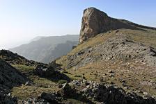
Flying over Abuna Josef (Abuna Yosef).
Abuna Yosef is a prominent mountain in the Lasta massif of the Ethiopian Highlands. At 4,260 metres (13,976 ft) it is the 6th tallest mountain in Ethiopia and the 19th highest of Africa. It is located in the Semien Wollo Zone of the Amhara Region. (*1)
 |
||
| Peak of Abuna Josef By Eliza Richman - CC BY-SA 3.0 |

From there we have to make a steep descent
to the southwest.
NOTICE: From this point on the flight plan is not realistic. I had to do various correction maneuvers with the plane in order to get down to the next waypoint.

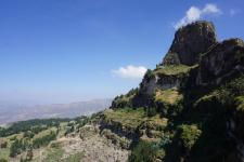
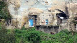
Flying near Asheton Maryam monastery area.
Home to only one priest, Asheton Maryam Monastery sits hidden in a rocky mountain. You have to hike to reach it, but when you get there the priest will welcome you and show the sacred items held in the monastery, including an illustrated Bible. On the way up, you'll pass through farming fields that the villagers use for growing plants and vegetables.
 |
 |

Another nearly impossible descent takes us to Lalibella
(Lalibela).
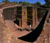
Lalibela is a town in the Amhara Region of Ethiopia. Located in the Lasta district and North Wollo Zone, it is a tourist site for its famous rock-cut monolithic churches. The whole of Lalibela is a large and important site for the antiquity, medieval, and post-medieval civilization of Ethiopia.To Christians, Lalibela is one of Ethiopia's holiest cities, and a center of pilgrimage.
Ethiopia was one of the earliest nations to adopt Christianity in the first half of the 4th century, and its historical roots date to the time of the Apostles. The churches themselves date from the 7th to 13th centuries, and are traditionally dated to the reign of the Zagwe (Agaw) king Gebre Mesqel Lalibela (r. ca. 1181–1221).
The layout and names of the major buildings in Lalibela are widely accepted, especially by local clergy, to be a symbolic representation of Jerusalem. This has led some experts to date the current church construction to the years following the capture of Jerusalem in 1187 by the Muslim leader Saladin.
Lalibela is roughly 2,500 metres (8,200 ft) above sea level. It is the main town in Lasta, which was formerly part of the Bugna district. The rock-hewn churches were declared a World Heritage Site in 1978. (*1)
 |
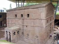 |
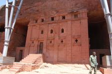 |
| Biete Ghiorgis By Sailko - CC BY 3.0 |
Bet Maryam By MarcD. - CC BY-SA 3.0 |
Bet Abba Libanos By Katie Hunt - CC BY 2.0 |

Another perspective of Lalibella
(Lalibela).
From here we go to the near airport and land in the runway 28.
NOTICE that the approach to runway 28 from here is very difficult. It might be easier use runway 10 but we haven't tried. After several manouvers we finally managed to land in runway 28.
Previous stage - Next stage
You can download for free this Flight Plan but only for your own private use. It is strictly forbidden to share it or publish it in other sites, forums, newsgroups or in any other way . You are encouraged to share and publish links to this page only, but not direct links to the file itself.
(*1) Credits: The descriptive texts are mainly an excerpt of those provided by Wikipedia. Visit Wikipedia to read the full descriptions.
See other MS Flight Simulator flight plans and instructions
Disclaimer: These instructions and flight plan are intended to be used only for MS Flight Simulator and should not be used for real flights.